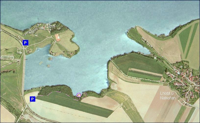
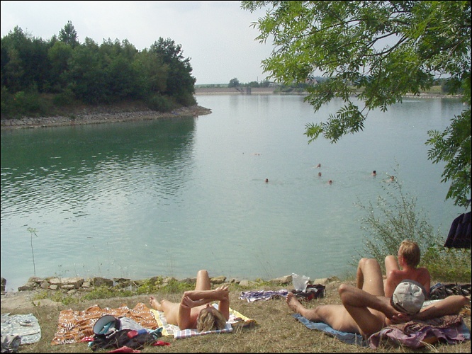
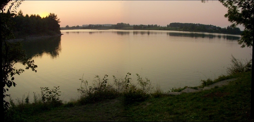
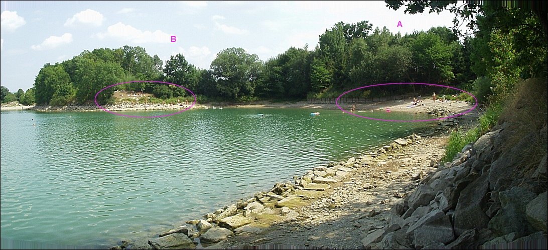
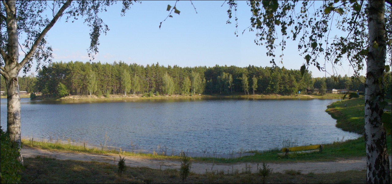
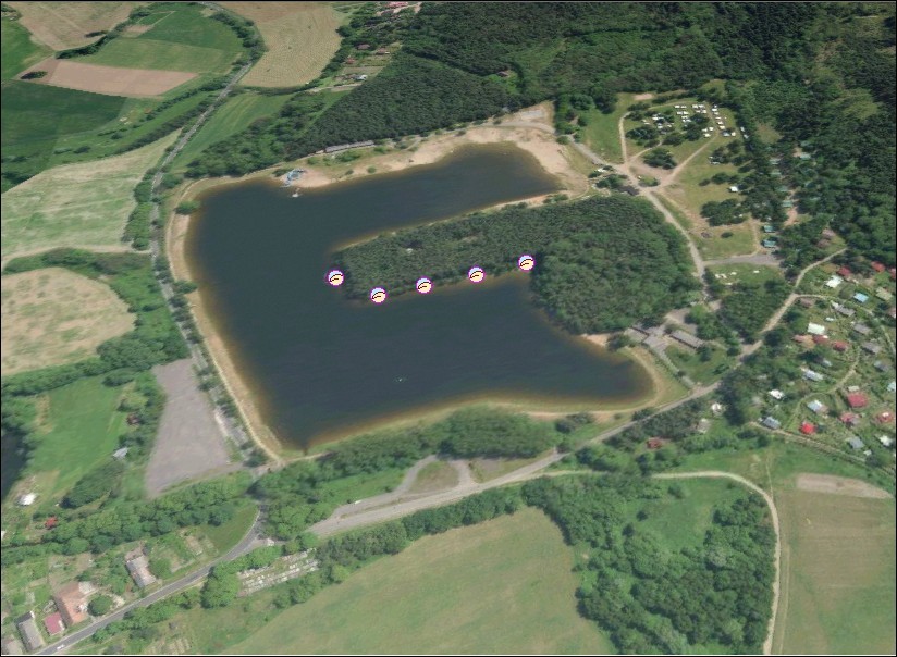
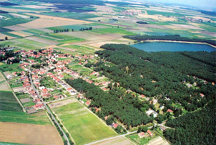
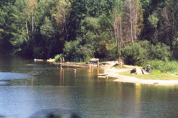
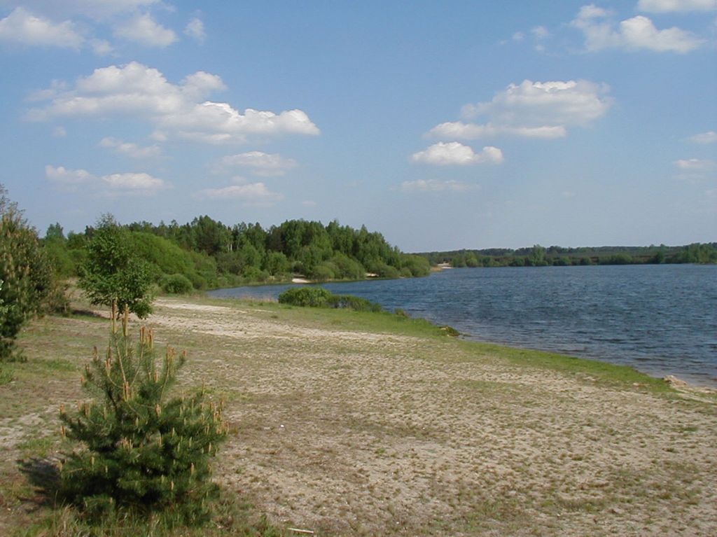
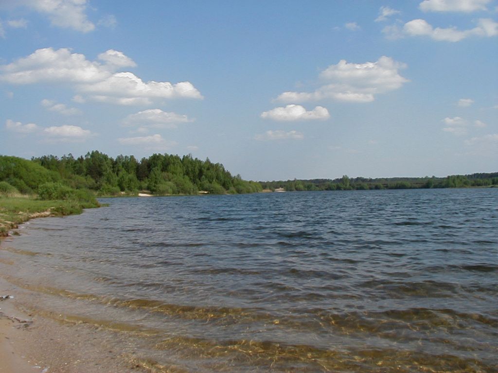
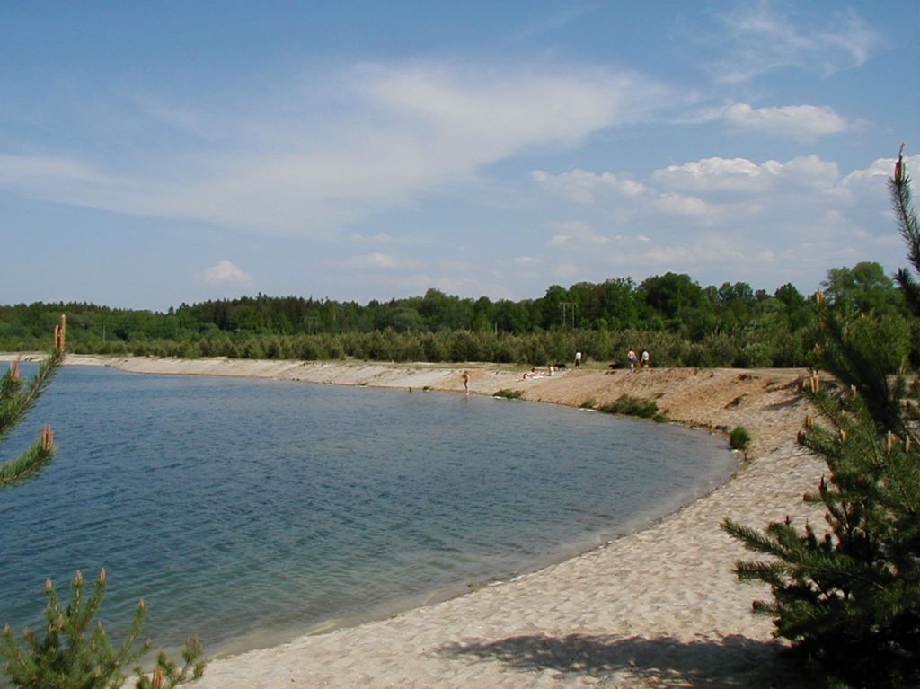
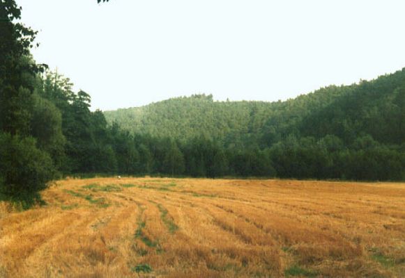
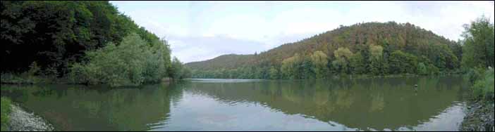
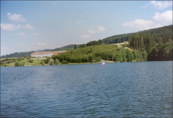
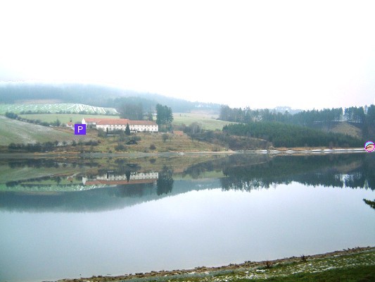
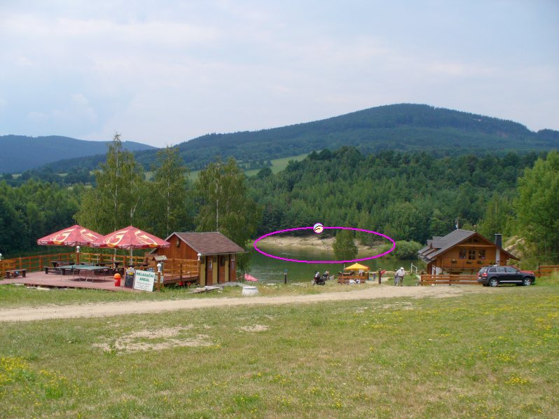
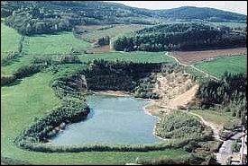
1. Rozkos
- Nove Mesto nad Metuji 4 km
- valley reservoir 9 km²
- camps Serec, Ceska Skalice
- plan, maps
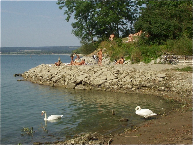
- u hraze (near the dam)
- two parts 40 m distant: A) clay
and B) grassy & rocky
- beach length 2x20 - 200 m depending on water level, 10-50 naturists
- depth to 20 m implies relatively clean water
- parking 500 m on field path or 1 km on a parking place (over the dam)
- map, access to B, aerial views: overall, closer
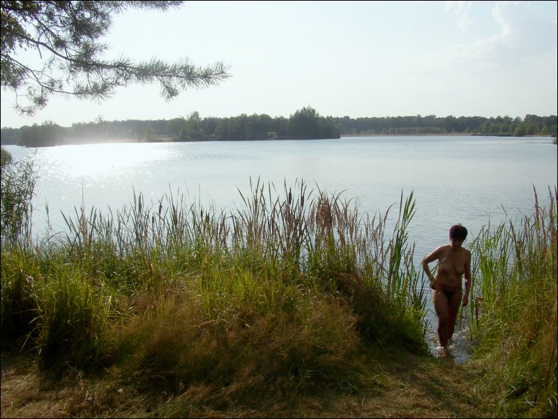
- view when water is high: from A towards B,
from B towards A,
close to B,
steps to B,
from B westwards,
sunset from B
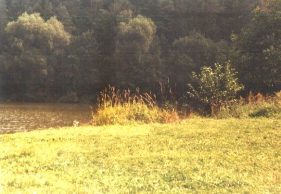
- at water level -1 m:
B waterside detail,
from lower part of B northwards,
from B to A,
from B westwards,
towards B and
overall B and A
- at water level -2 m:
B,
B from the air and
one more time
- at water level -4 m (September 2003):
B
- Serec (east beach)

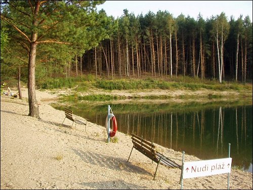
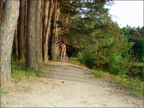
2. U dubu (north beach)
- Tyniste nad Orlici
- former sand quarry 0.01 km²
- official with entry fee 25/15 (2007) (20/10 (2002))
- operational 9-21
- N-beach length 30 m, 10-30 naturists
- refreshment facility at textile beach (50 m)
- views: aerial overview, aerial closer, from the entrance eastwards,
from the entrance panoramatic
(detail),
from the cashier panoramatic,
beginning,
from the south,
from the east,
from the beach southwards
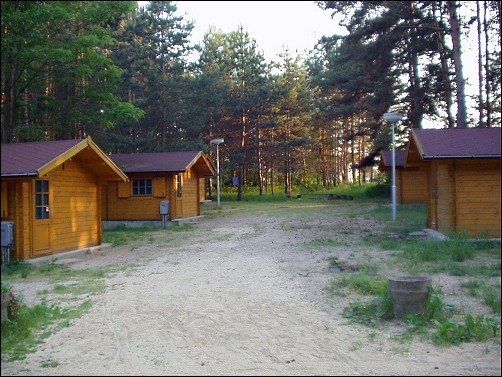
- textile bungalows (600 Kc/4 beds), phone (+420)494371686
- plan, detail, maps
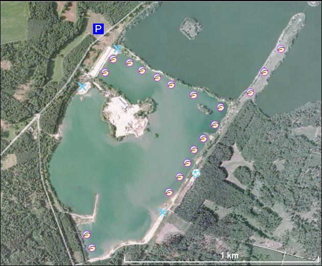
3. Malsova Lhota
- Stribrny rybnik
- Hradec Kralove 2 km (city bus)
- former sand quarry 0.05 km², quite clear water
- official, no entry fee
- several beaches on the peninsula, under pine trees; overall length 150 m; view from the entrance, closer, detail, from the camp, approaching closer, from the water, on the beach 1, 2, by the beach, towards the
entry gate, path along the beach, the same path backwards, volleyball playground
- refreshment facility at textile beach (100 m)
- textile camp 100 m
- plan, detail, aerial photo 1, aerial photo 2, maps
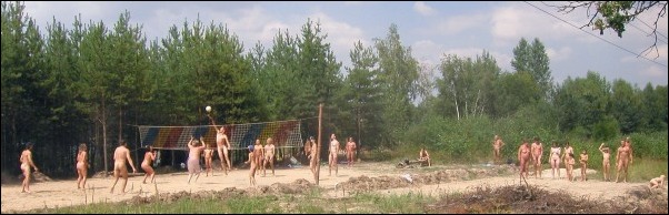
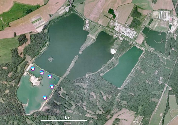
4. Oplatil, Hradek
- Stare Zdanice 2 km, Hradek 3 km, Bohdanec 5 km
- sand quarry 0.6 km²
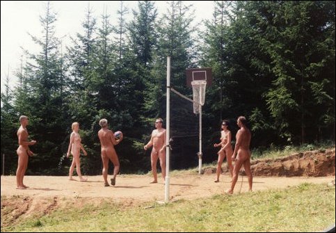
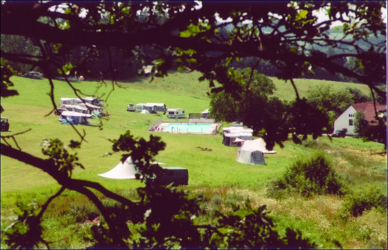
- strand length 1400 m, hundreds of people, tens of small beaches, volleyball playground and petangue playground, N-walks, several kilometers of N-footpaths, surrounding meadows, swing rope on the isle
- swimming not allowed in the northern lake - Oplatil (water source)
- refreshment facility: both on N and T beaches
- east side: view from the beach,
along the beach,
solstice sunset
- western beach by the road 333
- plan, sat. photo, aerial photo, aerial detail, maps
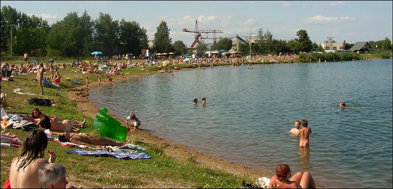
5. Opatovice nad Labem (west)
- Opatak
- Hradec Kralove 3 km
- sand quarry 1.5 km²
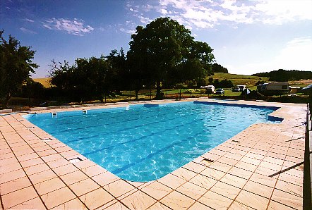
- grassy beach cca 200 x 20 m, no trees
- N-beach (western) length 200 m (hundreds of naturists), CO-beach (southern) length 400 m
- refreshment facility N(west) and T(south-west)
- beach across the lake from south-east, closer ..., early morning from south, afternoon from north, from the beach eastwards, late evening from south
- plan, aerial photo, aerial photo 1, aerial photo 2, maps
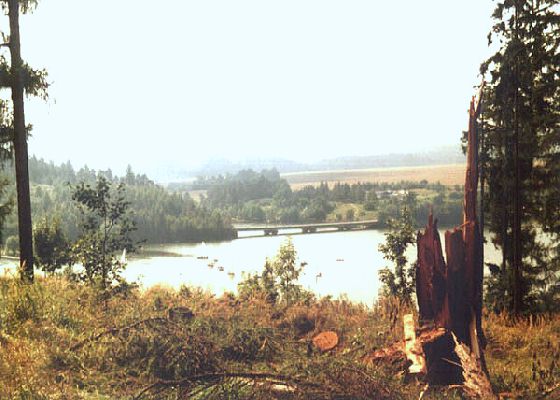
6. Rusek and Smirice
plan
a) Rusek
- Rusek 1 km, Skalicka 2 km, Hradec Kralove 6 km
- former sand quarry 0.1 km²
- clothing optional, usually 5-20 naturists
- view north-westwards,
one of the beaches,
eastern side has
steeper bank, from east to north-west, eastwards, western grassy, beach , aerial photo 1, aerial photo 2
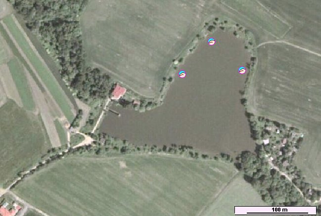
- detail Rusek, refreshment facility: Rusek (1 km) shop, restaurant
b) Smirice
- Smirice, Skalice 2 km, Hradec Kralove 8 km
- former sand quarry 0.05 km²
- clothing optional on several small beaches in NW
part, usually 2-10 naturists
- view from the N-beach north-eastwards, panoramatic SE-wards,
along the northern beach, aerial photo
- detail Smirice, maps
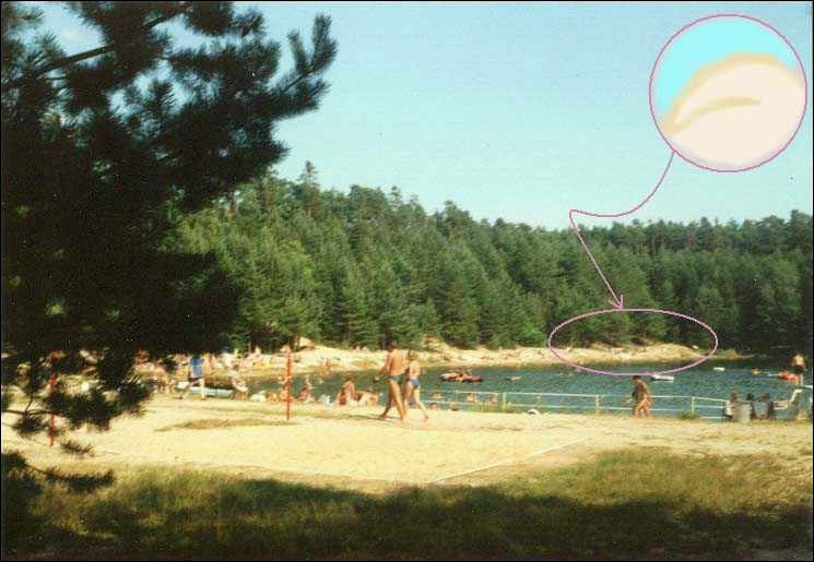
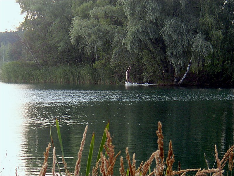
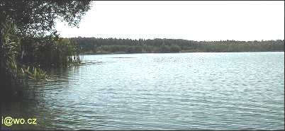
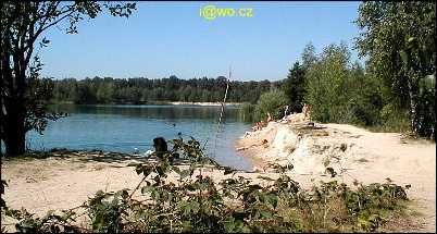
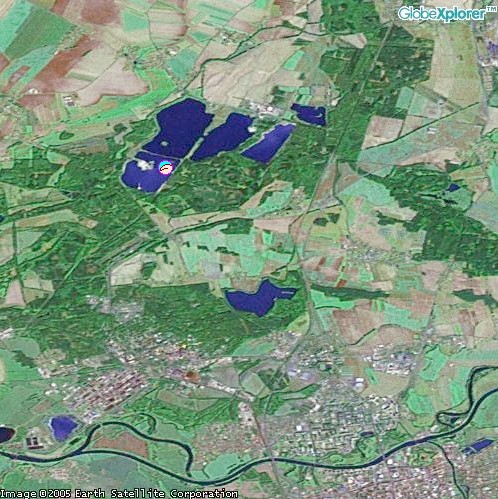
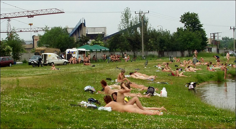
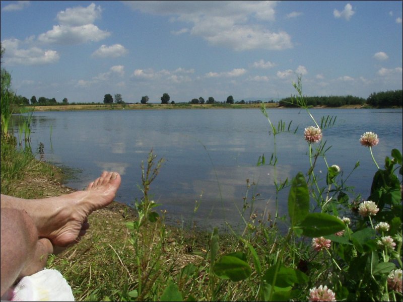
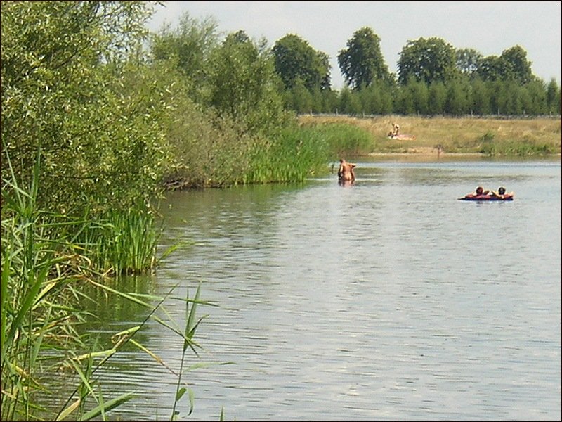
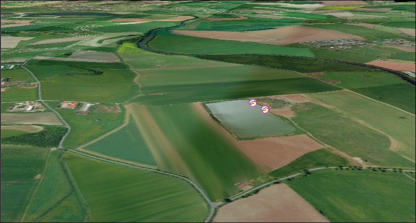
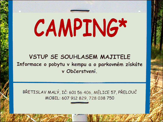
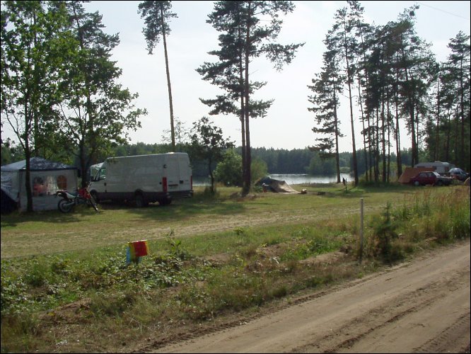
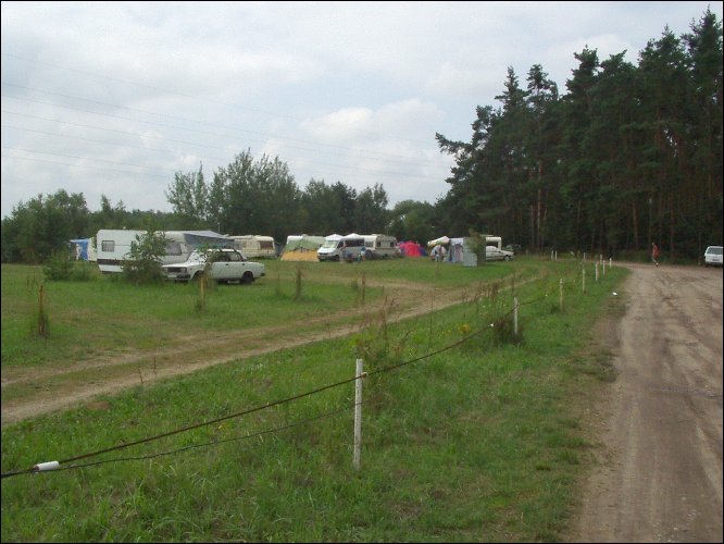
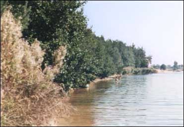
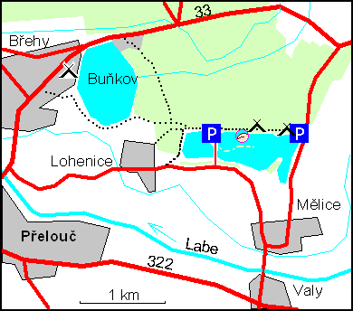
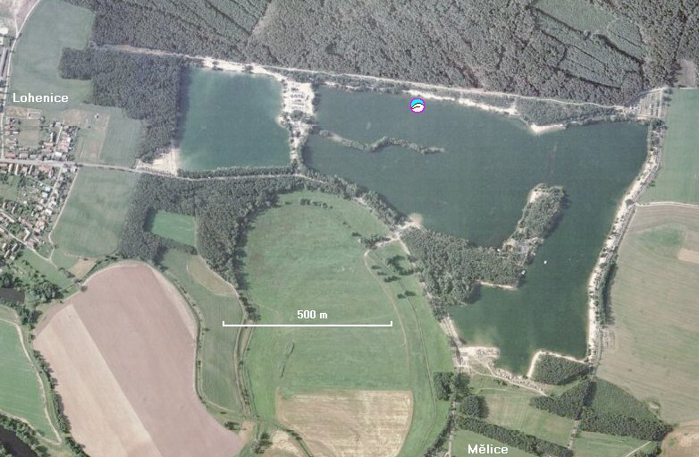
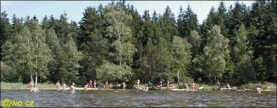
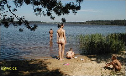
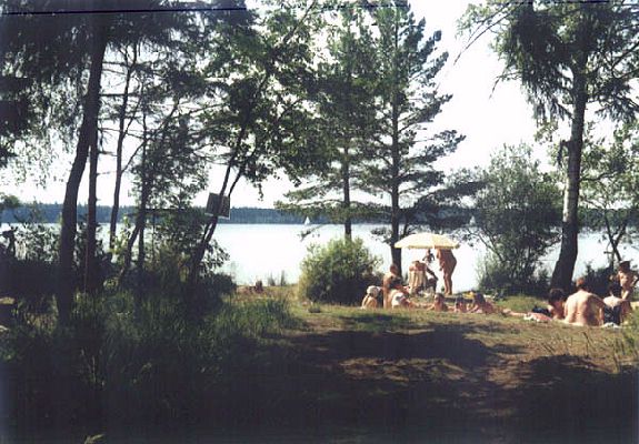
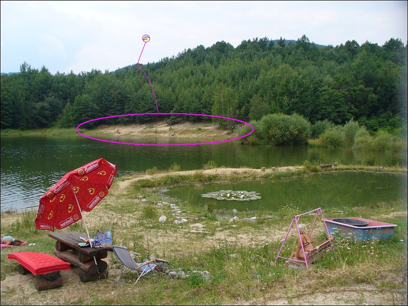
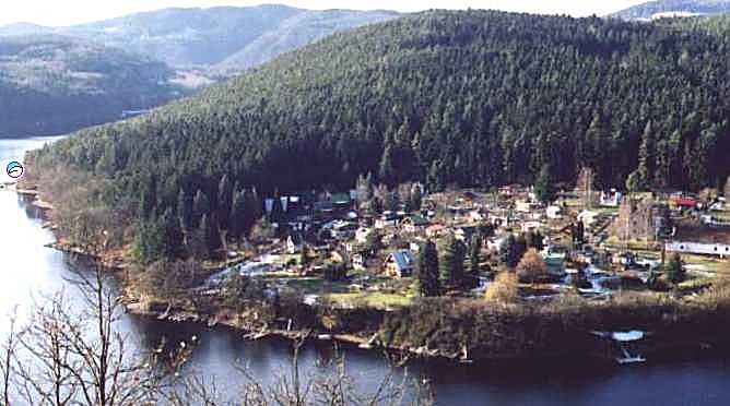
7. Melice
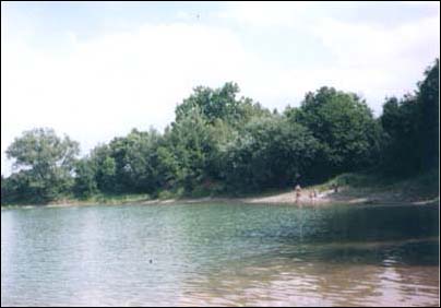
- Melice, Lohenice
- Prelouc 4 km
- former sand quarry 0.35 km²
- pines cleared from the beach by the owner in 2002, so use your own sunshade
- camp by the N-beach, western part is N. Prices: person 20, car 20, tent 40 Kc per day
- another textile camping near the eastern parking (200 m from the N-beach)
- camp Brehy 2 km (by car 5 km) (in Czech)
- N-beach length: 50 m; tens of naturists, T part grows :-(
- refreshment facilities at textile beach (20 - 200 m)
- views (2001)
from the lake,
along the beach
and in the evening
from the path and
on the beach
- views (2003)
from -,
and towards the isle in the evening.
- plan, aerial photo, maps
8. Petruv palouk
- Pastviny, near the dam
- Zamberk
- valley reservoir 0.5 km²
- clean, relatively colder water (470 m above sea level)
- steep bottom
- near entrance gate, with fishermen, aside textile beach; Rather find some unofficial place elsewhere.
- beach length 10 m, very few N-people
- with entry fee
- plan
9. Pod Karlovem - in 2003 forbidden by the landlord Kinsky :-(((
In 2006 the fence broke, the old beach starts again! ;-)
9. Velke Darko - new since 2003
- Velke Darko (south)
- Skrdlovice 1.5 km; Zdar nad Sazavou 12 km
- pond 2 km²; slightly acid medicinal water (bottom sand and peat); may be colder -
615 meters above sea level
- in the camp near the dam, NE part
- refreshment facility in the T-camp
- plan, maps
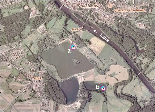
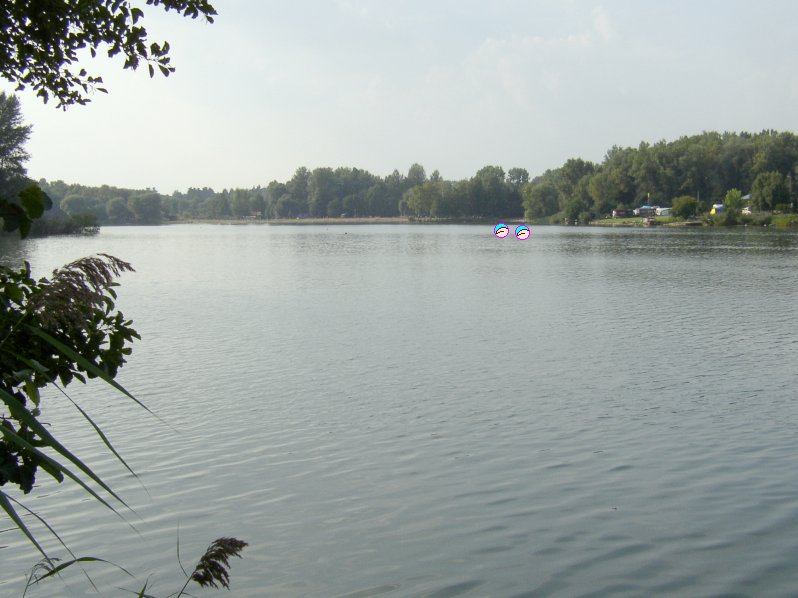
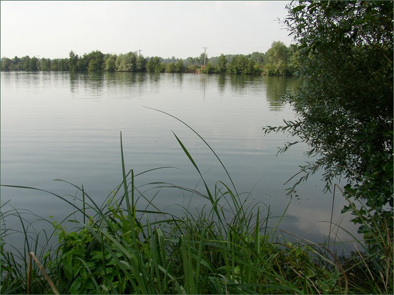
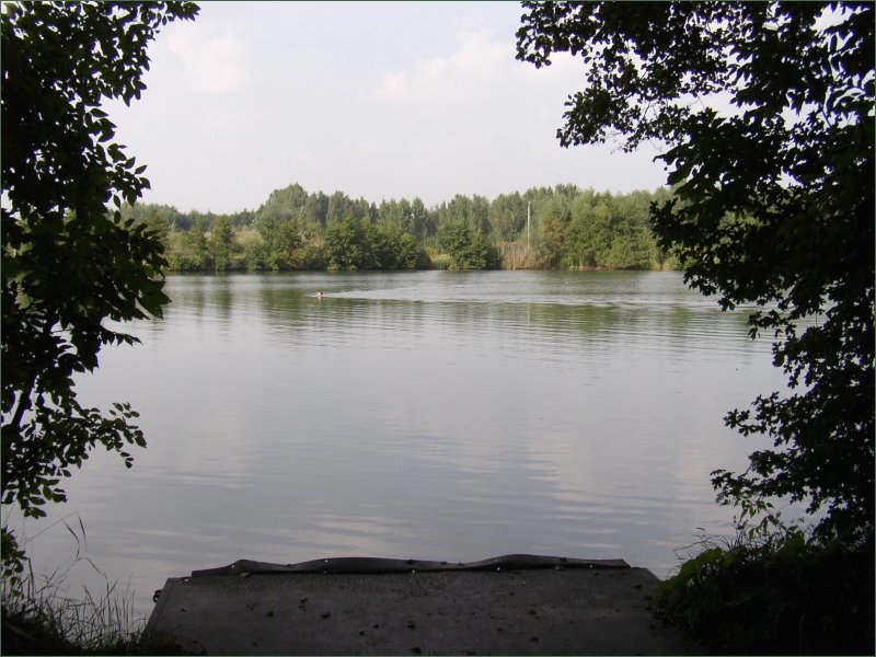
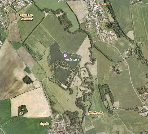
10. Jezero, Podebrady
- Jezero, 0.27 km²
- near village Kluk (parking)
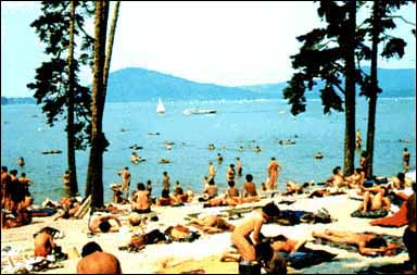
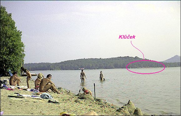
11. Machovo jezero
- Klucek (east beach)
- Doksy 1 km
- official with entry fee (2002: 25/15)
- clothing optional (N:T = 1:10)
- beach length 80 m
- usually quite crowded
- water slide
- refreshment facility
- textile camp 0.5 km
- Pod Bornym (north beach)
- Doksy 6 km
- official with entry fee (2002: 15/10), 100 m part of the beach is traditionally N
- a view from the beach southwards
- refreshment facility at textile beach (100 - 200 m)
- part of the camp near the N-beach is CO
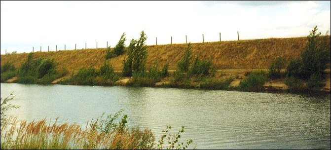
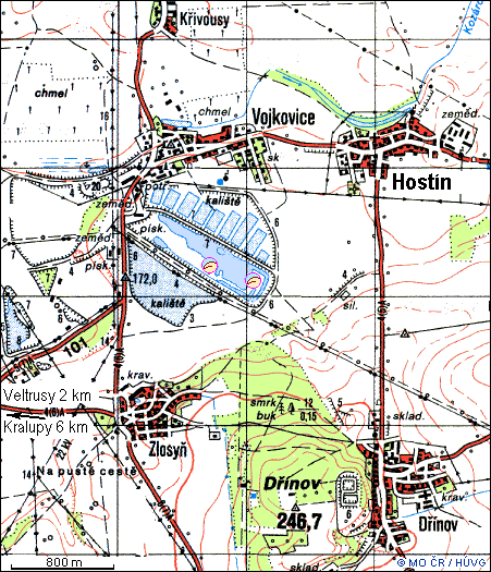
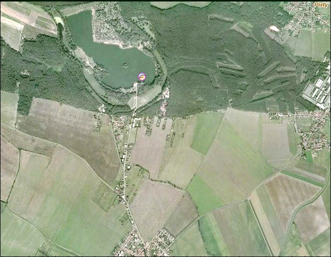
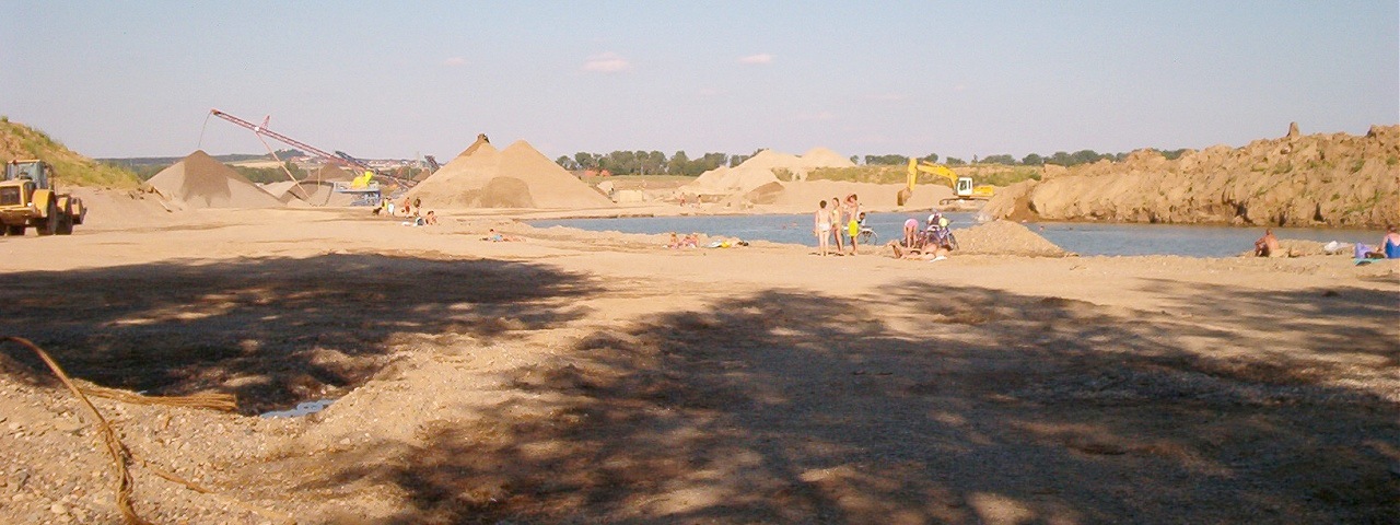
12. Vojkovice
13. Sadska
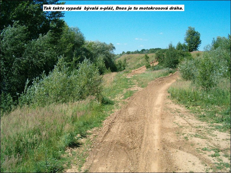
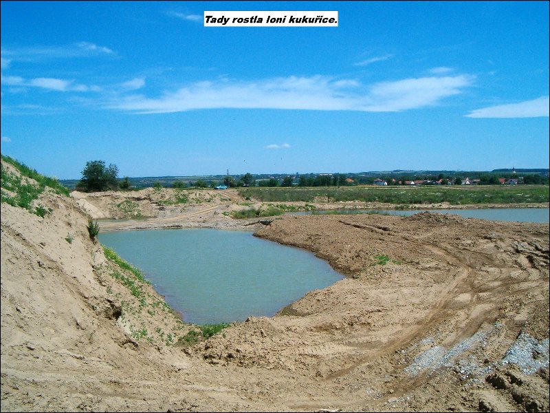
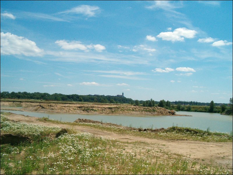
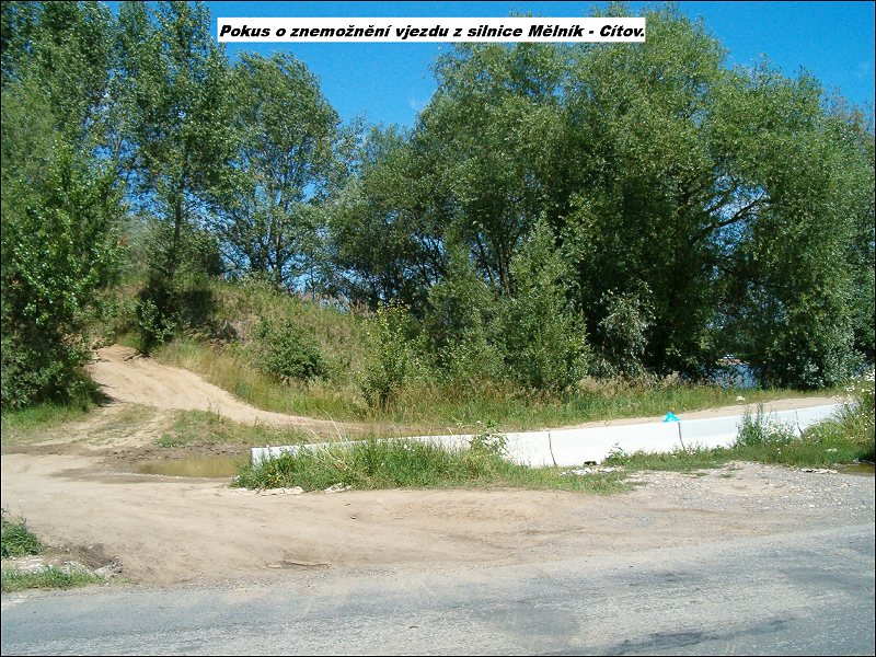
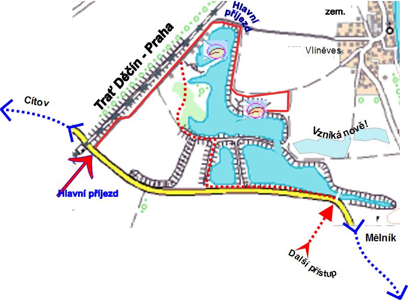
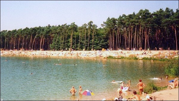
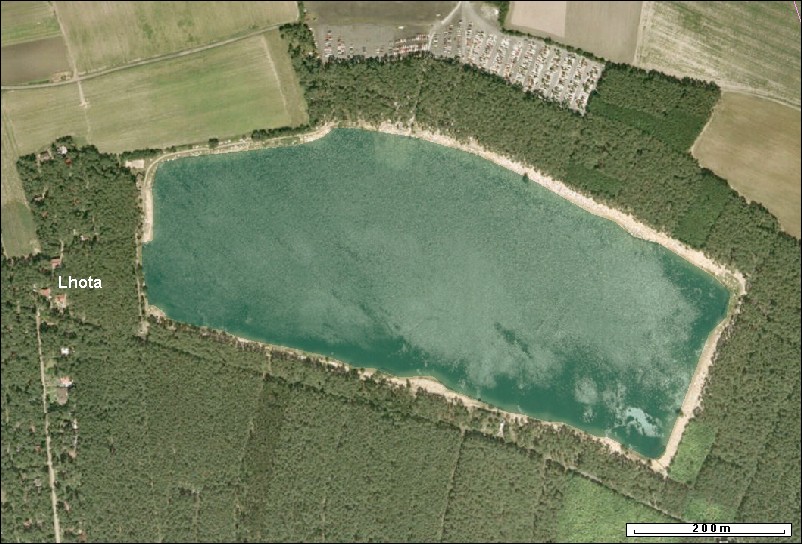
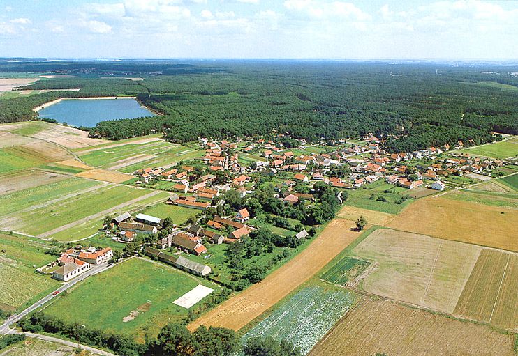
14. Citov, Baraba
- Baraba
- Citov 2 km, Melnik 4 km
- camping is tolerated; no facilities available
- Melnik
- former sand quarry, however the water quality may get worse due to sinking water, leaking to other sand quarries in surroundings
- new sand quarries are new potential N-localities
- photos 2006: former n-beach,
lake from 2004,
new lake in the field,
new lake Vlineves,
new lake Vlineves 2,
new lake Vlineves-Melnik.jpg,
tents on west bank of the old lake,
no drive in,
no entry
- plan, maps
15. Stara Boleslav
16. PRAHA - City
- Sarka
- Dzban
- Praha (city tram 9, 10, (7); bus 174, 179, 180, 184, 347, (167))
- valley reservoir 0.2 km²
- open 9:30 - 19:00, official with entry fee 50 Kc (2004: 40 Kc)
- large grassy beach (detail), WC, showers, refreshment
- on the opposite (southern) beach is a small unsupervised, CO meadow, no entry fee
- plan, maps
- aerial view
- textile camp
- textile camp and hostel
- Liboc
- Libocky rybnik
- Praha (city tram 1,2,18)
- pond 0.1 km², cleaner than Dzban
- grassy beach, bottom partly concrete
- textiles prevail, dogs allowed
- plan, maps
- Stvanice Isle - After 2002 floods still not operating :-((
- Zlute lazne After 2004 reconstructions no N-beach :-( But from July 2005 again N-sunbathing area available :-)
- T-swimming pool, N-river Vltava
- Praha - Podoli
- official with
entry fee 2006: 100/60/30/- (2005: 80/50/30/-)
- clothing optional only for sunbathing, textile swimming!
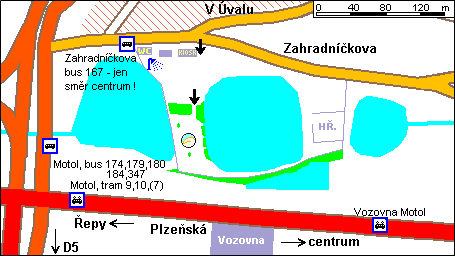
- Motol
- pond
- Praha (city tram 9, 10, (7); bus 174, 179, 180, 184, 347, (167)); entrance from crossing Zahradnickova - V Uvalu
- official with entry fee (2006: from 9AM - 50Kc, from 2PM - 40Kc, from 5PM - 30Kc, open 9-20)
- plan, maps
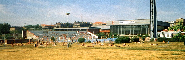
- Slavia
- swimming pool
- Praha - near Slavia football playground
- official with entry fee 2006: 80-110 (2002: 40-80)
- clothing optional only for sunbathing, textile swimming!
- maps
- Podoli
- swimming pool
- Praha - south
- official with entry fee (60Kc/1:30 h., 80Kc/2h., 90Kc/3h)
- aerial view
- clothing optional only for sunbathing, textile swimming!
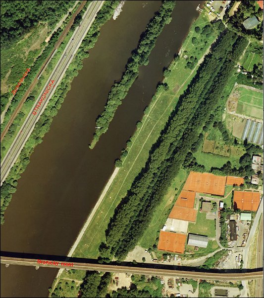
- Branik
- Vltava river
- Praha - Branik
- clothing optional, as yet very few naturists (2004)
- plan, aerial photo, maps
17. Pisek
18. Vlkov
19. Kladska
- Prameny
- Mytsky rybnik
- Marianske Lazne
- pond, peat bottom
- in forest
- plan, maps
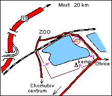
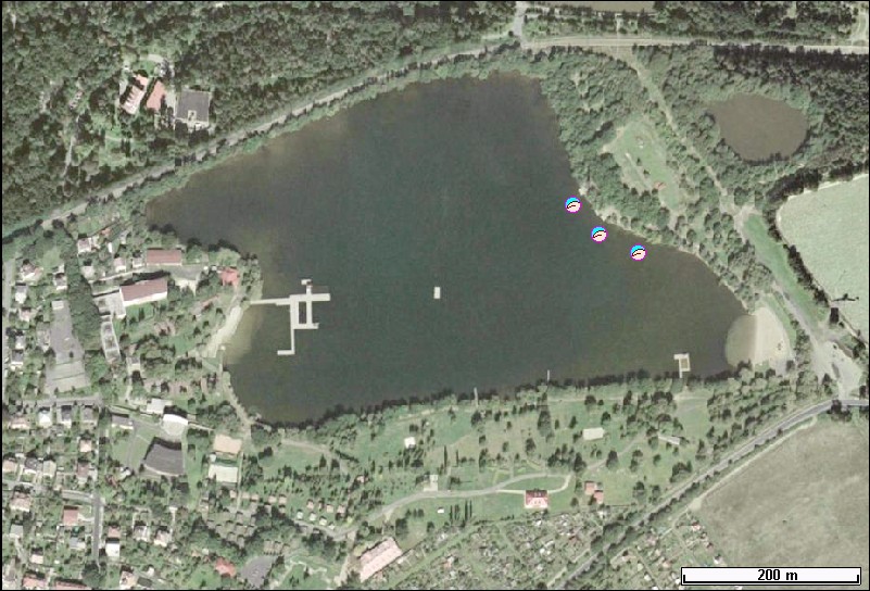
20. Chomutov
- Kamencove jezero
- Chomutov
- alum lake (slightly acid medicinal water, no water life), 0.16 km²
- official with entry fee (2001: 10,-), grassy beach, scattered trees
- refreshment on beach - only sometimes ice cream shop
- several refreshment facilities in textile part
- textile camp 500 m
- on near lake water ski towage
- plan, maps, aerial views: overall, detail
21. Hamrniky
- Lido
- Marianske Lazne
- pond 0.08 km², shallow - for children
- official with entry fee (2004: 30/15) Kc
- plan, maps
22. Popovice
- Koupaliste
- Beroun
- adapted pond, concrete bottom
- official with entry fee (25), separated part of the pool
- plan, maps
23. Pribram
- Novy rybnik
- Pribram
- pond
- official with entry fee (20), grassy beach
- refreshment facility on textile beach
- plan, maps
24. Tatrovice
- Chodov
- valley reservoir
- clean water, quiet environment, woods
- in 2001 naturists all around the lake
- sometimes smells nearby chemical plant (Vresova)
- plan, maps
25. Okrouhla
- Jesenice
- Cheb
- valley reservoir, tens of naturists
- plan, maps
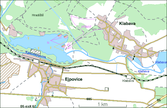
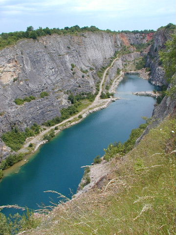
26. Ejpovice
- Rokycany 5 km, Ejpovice 3 km, Klabava 1 km
- former iron ore mine 0.4 km², depth up to 15 m
- plan, maps
27. Bolevec
- Bolevecky rybnik
- Plzen
- pond
- official with entry fee
- plan, maps
28. Bory
- Liticka prehrada, Ceske udoli
- Plzen
- valley reservoir 1 km²
- in Autocamp "INA", tel. (+420)377382654 in 2007 reported to be very poor, dirty, ... :((
- Vladimira Kurcova, Susicka 105, 31502 Plzen
- about 100 tents, 80 caravans
- clothing optional
- plan, maps
29. Pavlovice
- Plana u Marianskych Lazni
- Bezdekov
- stone quarry, ladders, 10-50 people, CO (N:T = 1:2)
- with entry fee (2004 = 0)
- no refreshment facility
- plan, maps
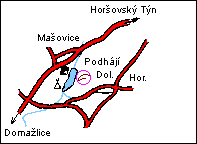
30. Podhaji In 2002 not operating. Reconstructions.
- Horsovsky Tyn
- pond
- sand
- official with entry fee
- plan
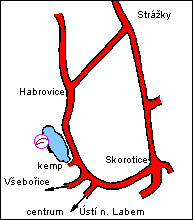
31. Habrovice
- Usti nad Labem
- pond 0.01 km²
- official, entry fee
- near textile camp (bungalows for rent)
- plan
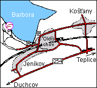
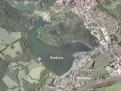
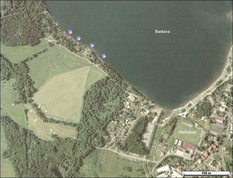
32. Oldrichov
- dul Barbora
- Teplice v Cechach
- former coal mine 0.5 km²
- clean water! but clay bottom, except several spots with sand cover
- grassy beach length 100 m
- parking 20 - 50 m
- refreshment in Oldrichov
- plan, aerial views: overall, closer
33. Dobrin
- Roudnice nad Labem
- sand quarry (operational)
- clothing optional
- refreshment on textile side
- plan, maps
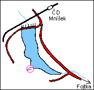
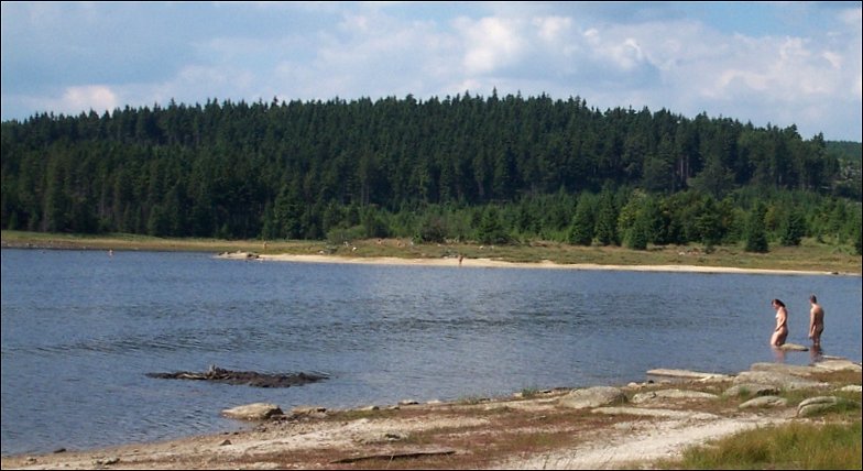
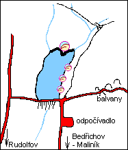
34. Mnisek
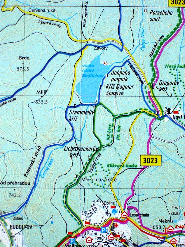
35. Bedrichov
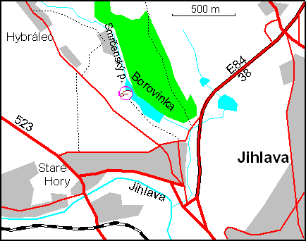
36. Jihlava - Borovinka, Jezirko
37. StrakoniceNO MORE AVAILABLE :-(( but at least the town swimming pool offers N-sunbathing.
- Horni Repicky
- Strakonice 3 km, Domanice 1 km
- pond
- plan, maps
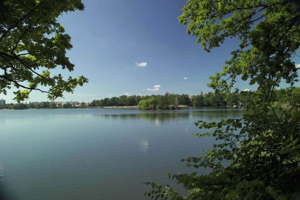
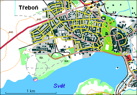
38. Trebon
39. Pytlak - in 2008 not operating due to reconstruction
- Lisnicky rybnik
- Milevsko
- pond
- local name: Nudist plac
- maps, no plan
40. Jinolice NO MORE N :-(
41. PRAHA - SOUTH
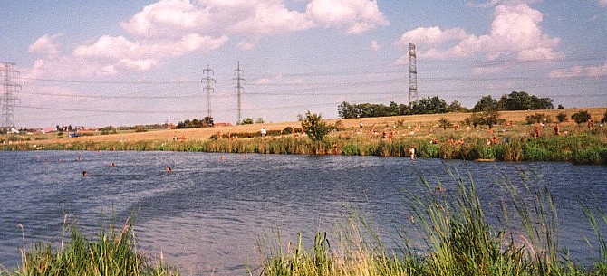
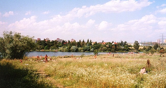
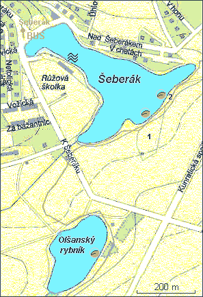
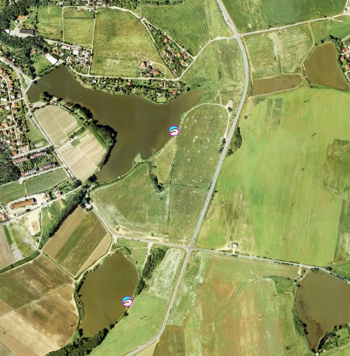
- Kunratice
- Olsansky rybnik 0.05 km², Seberak 0.1 km²
- Praha
- ponds, grassy beach (length 200 m), stony bottom
- bus 114 from Kacerov or 165 from Opatov metro C stations
- no facilities
- some N-pioneers occur also at Seberak paid (45 Kc) T-beach with basic T-facilities
- views
from the lake,
from the beach
- plan, maps
- aerial view
- paid part open 10 - 21
- textile camp 1 km
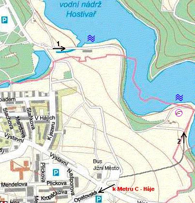
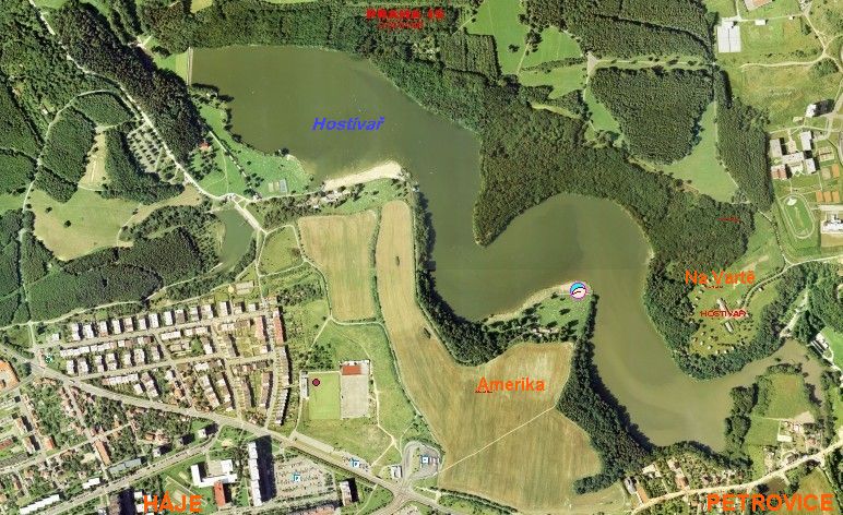
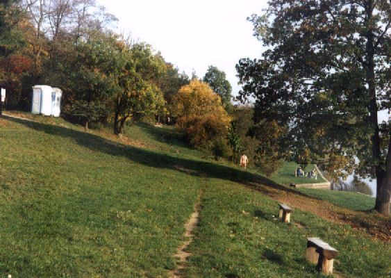
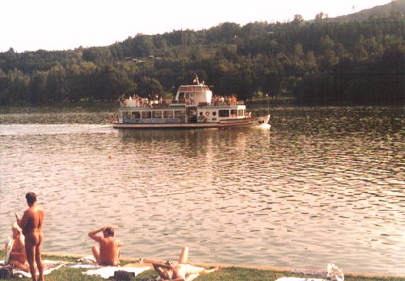
- Hostivar
- Oaza
- Praha - Jizni Mesto
- valley reservoir 0.5 km²
- beach 200 x 50 m, beach from the opposite side
- official, entry fee entry fee 50 (30 after 4PM) Kc, (2004:40/20), may be closed when the weather is not perfect
- refreshment facility, shower, WC, swans (polluted water)
- bus 165,170,203,212,213,227,260 from station Haje (metro C)
- plan, maps
- aerial view
- unofficial small CO beaches on the opposite side
42. Brnenska prehrada
- Bystrc
- Brno
- valley reservoir 2.5 km²
- official
- plan, maps
- Pod Taneckovym
- Osada
43. Karlovy Vary
- Sachta, Jama
- Cankov, Otovice, Karlovy Vary
- pond (former coal pit)
- plan, maps
- Lazne III
- swimming pool with entry fee (90)
- swimming pool 20 m, whirlpool, and two saunas (warm+hot)
- clothing is optional only except morning medical procedures
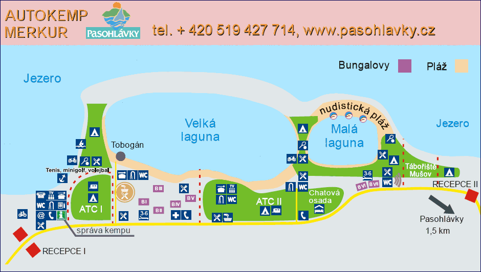
44. Pasohlavky, camp Merkur
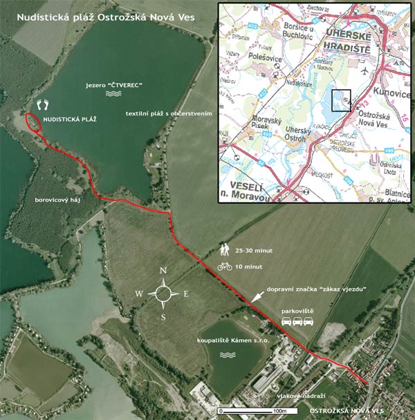
45. Ostrozska Nova Ves For 2005 announced renewed sand exploitation, thus closing for public :-(( Officially closed for public :((
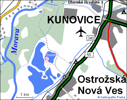
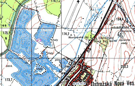
- Ctverec
- Ostrozska Nova Ves 1 km
- Uherske Hradiste 5 km
- sand quarry, depth 9 m, 0.3 km², bottom pebbles
- grassy beach 100 x 30 m, not steep, suitable for children
- parking "Jezero", refreshment 500 m (in textile part)
- views: over the water towards the beach (67k),
access to the beach (43k),
aside the beach (90k)
- plan, map, details, maps
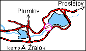
46. Plumlov
47. Repcin
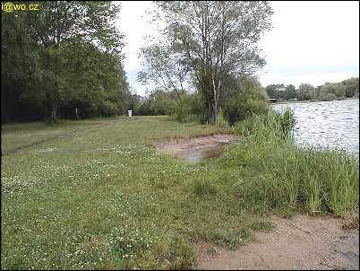
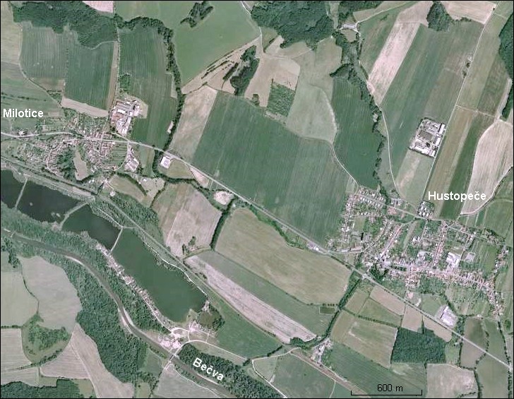
48. Hustopece
- 4-th lake, closer view
- Hustopece nad Becvou, Milotice nad Becvou
- Hranice na Morave
- former sand quarry, beach 50 x 50 m, the water quality may not be good
- refreshment 400 m (textile)
- plan, maps
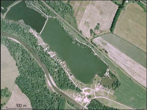
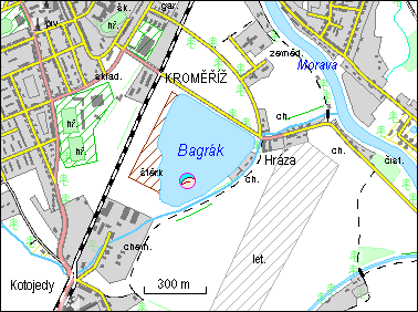
49. Kromeriz - Bagrak
- Bagrak, Hruby rybnik
- Kromeriz
- former sand quarry 0.15 km²
- near the stadium
- plan, aerial photo
50. Antosovice - aer. photo
- Ostrava-Bohumin
- sand quarry 0.85 km²
- grassy beach length 300 m, clean water from underground source
- official, entry fee per person, car, tent, ...
- volleyball, rowing, slide, bowling
- refreshment: N-kiosk on the beach + nearby T-restaurant
- plan, maps, from Bohumin
From 2005 another nearby N-beach Katka - Mzikovec
51. Olse, Karvina
- near VOKD building
- Karvina-Ostrava
- river
- beach length 200 m, grass, sand
- volleybal playground, seesaws, ...
- parking at VOKD building
- plan, maps
52. Hlucin
- Ostrava-Hlucin, Dehylov 1.5 km
- former sand quarry
- steep bottom
- official
- many facilities in textile part
- plan, detail, maps
53. Lubina
- Vetrkovicka prehrada, Pod hurkou
- Koprivnice
- pond
- grassy beach, clay bottom, volleyball playground
- refreshment facility on textile beach
- plan, maps
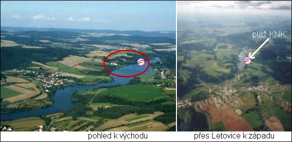
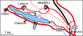
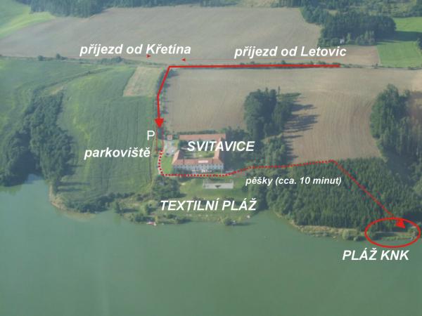
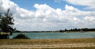
54. Kretinka
- Svitavice, Meziricko 1.5 km, Lazinov 1.5 km
- Letovice
- valley reservoir 1.1 km²
- official private beach 100 m²; owned by local N-group "Klub naturistu
Kretinka"
- no entry for single men (sorry); children under 15 must be accompanied by an adult
person; entry fee is voluntary
- small volleyball playground, picnic area
- accomodation in nearby (10 min. walk) hotel Svitavice, textile
besides N-week (see events)
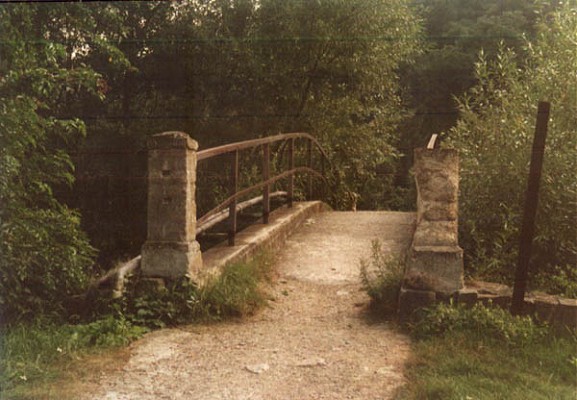
- views: from the bridge at the opposite beach,
from water to the beach,
over a cove,
over the beach westwards
page with more photos
- aerial photo, plan, maps, after parking near Svitavice some 200 m footway
55. Lhota nad Moravou
- Naklo, Lhota nad Moravou 1.5 km
- Litovel
- former sand quarry, noisy "water vehicles"
- beach length 100 m, width 1 - 5 m, a little steep
- refreshment facility on the opposite textile beach (1 km)
overall view
- plan, maps
56. Pisecna
Alternative: Near Jesenik one can N-swim in quarries between Vapenna and Zulova.
57. Petruv Dul
58. Kobylniky (south)
- Slapska prehrada, Vltava
- Chotilsko
- Prostredni Lhota, Sejcka Lhota
- valley reservoir 13 km²
- small beaches among houseboats, textiles prevail :-(
- narrow beach, steep rocky bottom, forest
- refreshment and parking: Kobylniky - restaurant (1 km)
- view from the opposite bank
- plan, maps
59. Nebory - 2003 reported change of owner and became NOT NATURIST :-((
- Podlesi
- Trinec
- swimming pool
- grassy beach
- no plan
60. Siberie
- Frenstat pod Radhostem
- concrete bottom
- grassy beach
- no plan, maps
61. Ceske Budejovice
- Velky Jez (Velky Splav)
- Stilec
- Kamenny Ujezd
- pond
- no plan, maps
62. Amerika
- Karlstejn
- lake
- rocks
- closed (:-((natural preserve, dangerous falling rocks!)
- no plan, maps
63. Matka Zeme - Mlecna draha
- NUDI CAMP 'Mother Earth - Milky Way'
- Bert en Wilk Schaak (NL), Racov 15
- 384 72 Zdikov
- Vimperk (12 km)
- tel. (+420) 388 426 222 or (+420) 721 982 572-cellular
- nudist camp (about 60 tent places, 40 caravans)
- price/day: 200 Kc/tent, 170 Kc/person
- swimming pool
- www pages
- plan, maps
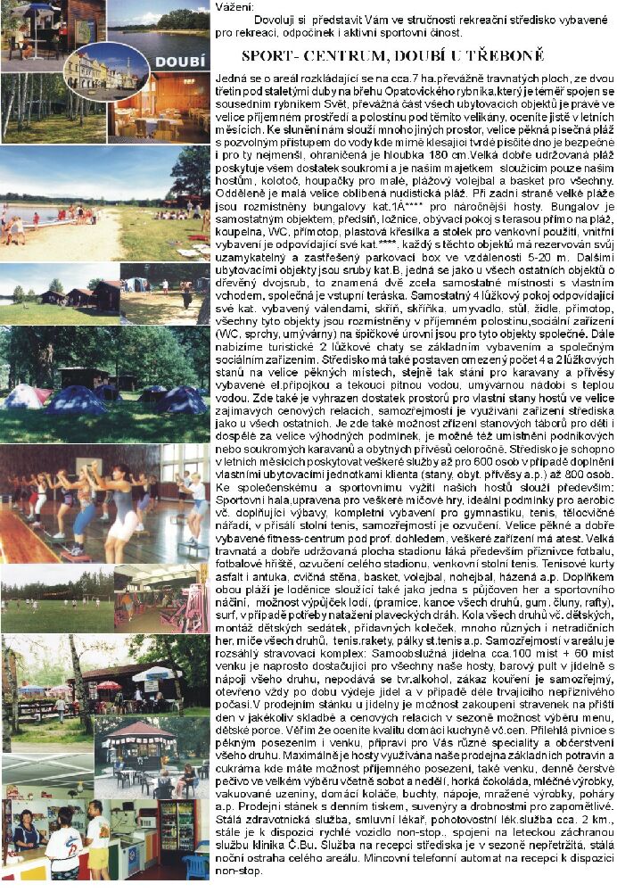
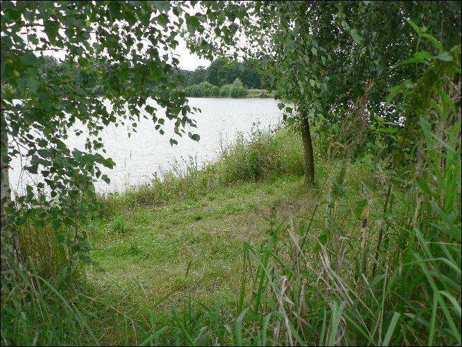
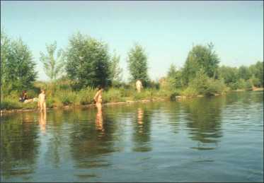
64. Sportcentrum Doubi - 2003 reported intention to close the N-beach :-((?)
- Branna u Trebone
- pond 0.8 km², sand bottom
-
textile camp (bungalows, tents) near the nudist beach
- N-week: 5.7. - 12.7. 2003 in an N-camp: 305 Kc/day w. half board
- contacts: doubi
 treb.cz, phone: (+420) 384 721 105, (+420)
384 724 371(fax), cell: (+420) 602 118 575, (+420) 604 121 965
treb.cz, phone: (+420) 384 721 105, (+420)
384 724 371(fax), cell: (+420) 602 118 575, (+420) 604 121 965
- maps, no plan
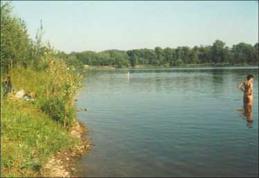
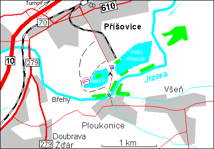
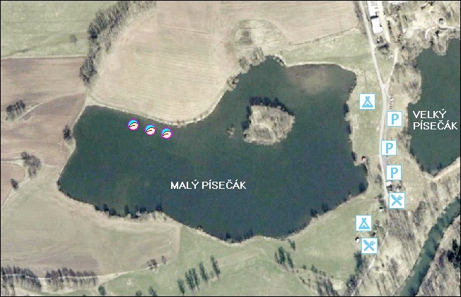
65. Prisovice near Turnov
- Maly Pisecak, NE beach
- Prisovice 600 m, Ploukonice 300 m
- former sand quarry 0.12 km²
- 100 m shore with several grassy beaches, few trees, 300 m from parking
- view over the lake, from the lake,
along the beach,
from the beach
- depth 1-2 m,
shore depth safe for children, bottom
gravel, sand, mud
- by car only from Prisovice, by foot from Ploukonice, too
- textile camp on the oposite side of the water body
- (textile) windsurfing and fishing at Velky Pisecak
- textile camp and refreshment between the two water bodies
- plan, maps, aerial view
66. Olesna
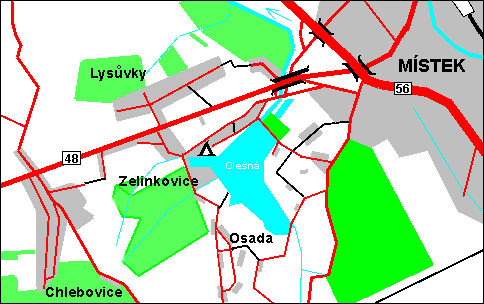
- Frydek-Mistek 3 km, Zelinkovice
- reservoir 0.5 km²
- beach length 400 m
- official
- refreshment 100 m - fish (textile)
- textile camp on the other side
- plan, maps
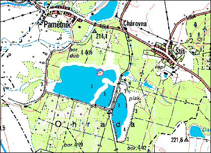
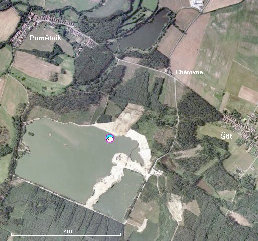
67. Pametnik
68. Pistany
- Piskovna
- Litomerice - 4 km west
- sand quarry 1 km²
- beach length ? m
- refreshment ? (textile)
- plan
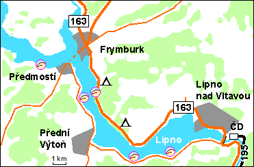
69. Lipno
- Lipno
- Frymburk - 3 km south
- valley reservoir 45.5 km², altitude 720 m
- beach length 500 m
- clothing optional
- grass, among trees
- bottom sand and pebbles, slight descent
- textile camp and refreshment 2 km
- see also SW bank: 40 km of rarely visited sand beaches
- plan, maps
70. Adrspach
- Dolni Adrspach, Piskovna
- lake 0.05 km²
- clothing optional
- grass, among trees, sandstone
- entry fee to the Rock Town 40 Kc/day or 100 Kc/season
- bathing is often prosecuted - natural reserve (:-((
- plan, maps
- view to rock towers,
from beach,
from a rock tower
71. Klatovy
- Klatovy
- city swimming pool
- only sunbathing, bathing is textile
- grass, wooden plates
- entry fee
- plan
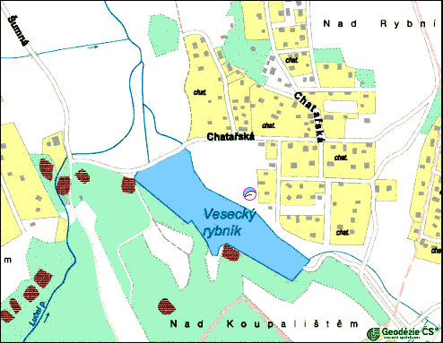
72. Vesecky rybnik & Jablonec-Taiwan
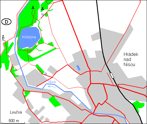
73. Kristyna
- Hradek nad Nisou, Zittau
- quarry 0.02 km², depth max. 28 m
- grass
- refreshment at textile part
- plan, aerial view
74.
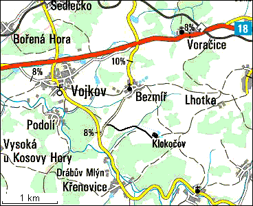
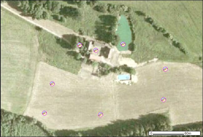
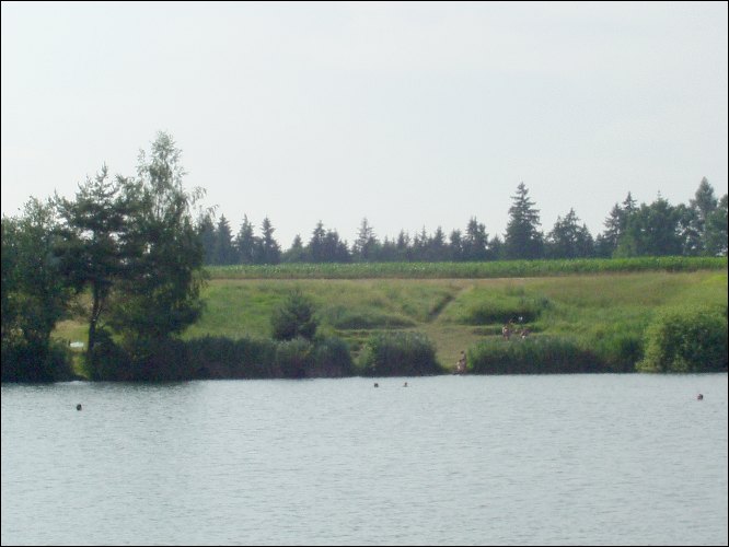
Klokocov
- FKK CAMP operating from mid June to August
- capacity: large meadow, tens of tents
- price cca 750 Kc/family/day
- pond 0.01 ha, depth 1 - 2 m
- swimming pool 10 x 20 m, overview since 2002
- pub, yard
- address: Bezmir 18, 257 54 Vojkov
- Sedlcany, Votice (10 km)
- tel./fax. (+420) 317729053 / 317729055 (only in July & August),
e-mail: Klokocovhome.nl
- plan, aerial overview, ... closer ..., and detail, maps, highway D3 over the camp
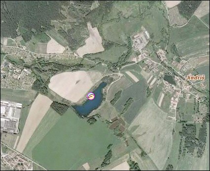
75. Jindris
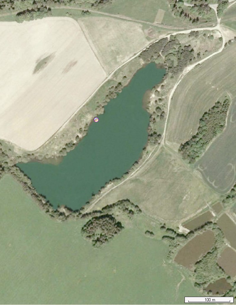
76. Suchdol
- former sand quarry, 0.04 km²
- Suchdol nad Luznici(1 km)
- on a former island
- no refreshment facility
- plan, maps
77. Vichov and Vranov near Stribro
- pond Vichovsky rybnik (Vichovak), 0.19 km²
- Vichov 1 km, Stribro (5 km)
- official CO beach by a textile camp
- plank, aerial photo
- Vranov - N-beach existence recently not confirmed :(
- valley reservoir Hracholusky, 4.7 km²
- Stribro (4 km)
- near a textile camp
- refreshment facility in the camp (phone (+420) 374623385
- plan
78. Cinovec
- pond Dlouhy rybnik, 0.02 km²
- Dubi (9 km), Teplice
- plan, view, maps
79. Orlik - Klucenice and Charvatska stran
- valley reservoir Orlik, 20 km²
a)
- Podskali, Klucenice (4 km)
- to the N-beach need to cross a bay from the camp Podskali
- plan, maps
b)
- Charvatska stran
- pebble N-beach (length 200-300 m), no facilities, at the E end CO
- to the N-beach need to cross the reservoir from the camp Radava
- plan, maps
80. Tisice
81. Susice
- small river Otava
- Patecek, Cerveny Dvorec, Susice (2 km)
- no refreshment facility
- plan
82. Nechranice
- valley reservoir Nechranice (river Ohre), 13.38 km², max. depth 46 m
- a) Vikletice; b) the opposite bank
- depth near the beach up to 20 m
- no refreshment facility
- plan
83. Olomouc
84. Tovacov
- half way from Prerov to Prostejov
- former sand quarries, x.x km²
- the eastern one is forbidden ;-( drinking water reservoir
- several small beaches
- plan, maps
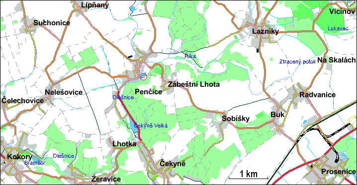
85. Pencice
- 7 km north of Prerov
- 50 m swimming pool and two shallow pools for children
- official with entry fee 30/15 Kc (from June 11: weekends 10-18, July-August 10-20)
- clothing optional only for sunbathing (terrace with wodden
deckchairs + shower), but textile swimming, playground and restaurant!
- plan
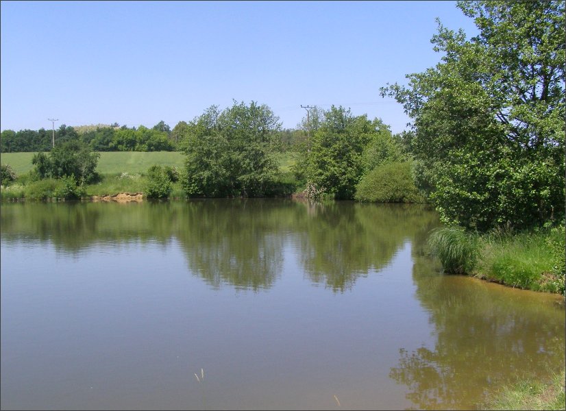
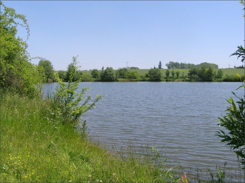
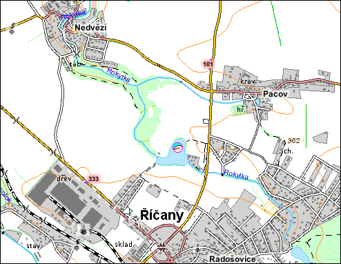
86. Ricany
- towards Nedvezi, access from road Ricany - Pacov westwards
- pond unofficially called Prehrada, 3.5 ha, depth over 2 m, quite clean water
- few small grassy CO-beaches separated by trees
- views 1, 2, 3, dam, incoming creek
- plan,
aerial view,
maps
87. Telc
- pond Horni Mrzatec
- Between villages Mrakotin and Lhotka, raw nature
- clean water, muddy bottom, calamus
- western beach, usually up to 10 people, under trees
- plan, maps
88. Uhersky Brod
- Centrum pohybovych aktivit DELFIN, Slovacke namesti 2377, 688 01 Uhersky Brod
- tel. 572 619 541, fax: 572 619 522, mail: infodelfinub.cz
- official
- grassy yard of the finnish sauna with cooling pool
- view: cooling pool
- plan
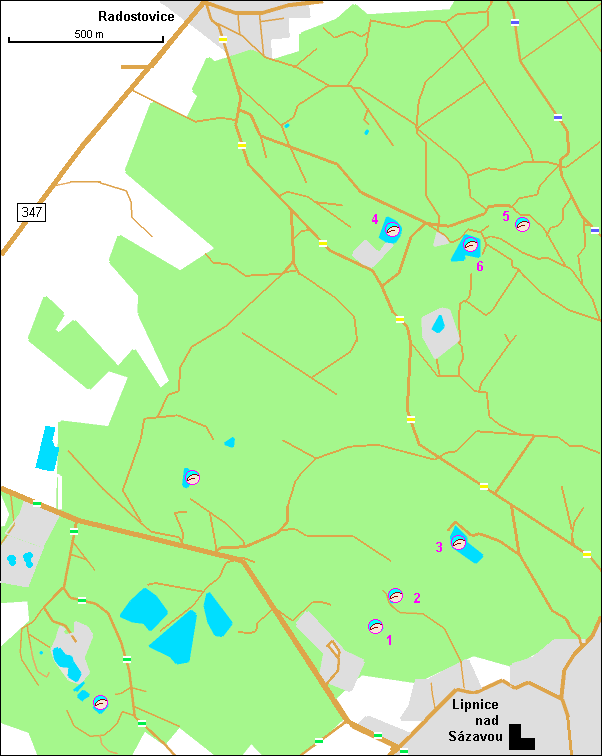
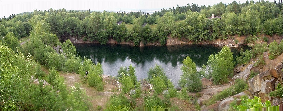
89. Lipnice nad Sazavou
- Lipnice nad Sazavou, Radostovice, Havl. Brod, Humpolec
- several abandoned stone quarries (granite)
- besides those marked in the plan, other
small ones may be more cozy
- "wild" nature, clean water, difficult approach (cars not allowed on forestry roads)
- capacity several people (textiles may prevail, but never mind)
- views 1, 2, 3a, 3b, 4a, 4b, 5, 6
- plan, maps, aerial view south - north
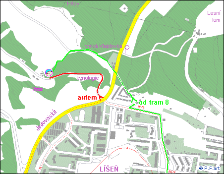
90. Ruzenin lom, Pod Hady
- Brno-Lisen
- several shalow ponds with grassy beaches
- protected natural area, but access is not forbidden
- textiles usually prevail
- a lot of dogs, even if dogs are fobidden here
- view 1,
- plan, maps
91. Mohelnice
- Mohelnice, Moravicany - 2 km
- two sand quarries, each 0,4 km², the southern one no more exploited
- the beach overgrown by grass, trees, length 200 m
- shared with textiles and fishermen
- aerial view
- plan, maps
92. Frantiskovy Lazne
- textile Auto Camp Jadran
- entry fee; in the remote part of the beach nudity is tolerated
- maps
93. Rakovnik
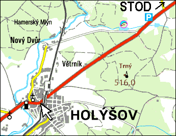
94. Holysov
- Holysov 2 km, Stod 2 km, Plzen 15 km
- pond in a forest, 0.02 km²
- CO, but often only textiles, no nudists :-(
- view towards the beach
- plan, maps
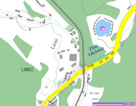
95. Libec
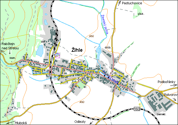
96. Zihle
- 30 km N of Plzen
- family pension with 7 beds in 3 bedrooms + bathroom, kitchen, TV room
- nudist mode only when all accomodated agree. (Rent all rooms! It is not expensive!)
- garden 1500 m² for tents, 2 outdoor pools (~5m)
- plan, maps
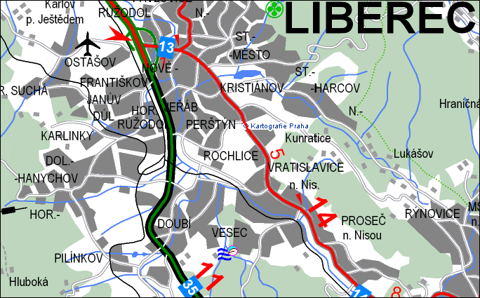
97. Liberec
98. Radnice
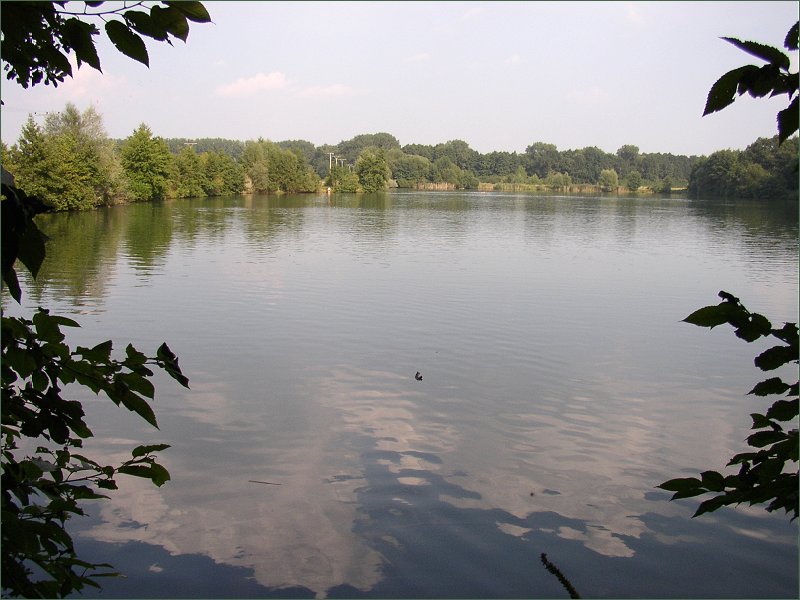
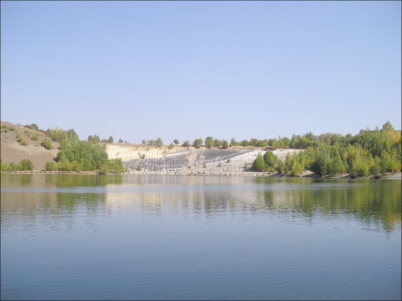
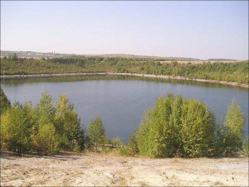
- Jezero, S of Radnice
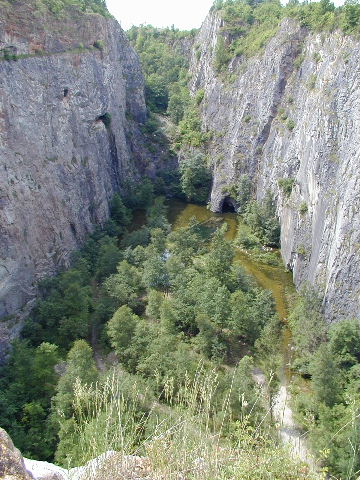
- Former coal quarry, but don't worry :-) The water is clean.
- Depth 1 to 20 m, area 0.05 km², grassy and rocky beach.
- Nudists tolerated on the west beach
- view northwards, southwards
- plan
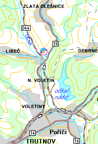
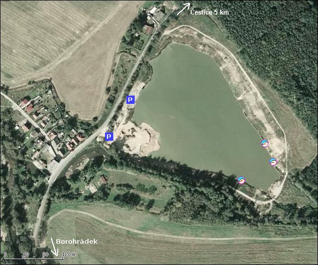
99. Orlice, Borohradek
- river (Ticha) Orlice in the span between Chocen and Hradec Kralove
- small beaches in meanders, some CO, some T, some empty
- depth 0 - 2 m, stream 0 - 2 m/s, sand, grass and pebbles beach. Somwhere even wooden ;-).
- the best approach is by canoe going downstream
- some beaches are suitable for camping
- near Borohradek by the right bank a new sand quarry (4.3 ha), in the E part use to be Ns
- parking by the road 318 from Borohradek towards Cestice, on W bank of the lake
- view from the road (parking) and over the lake towards the parking, aerial view, maps
100. Horni Brusnice
- Dvur Kralove nad Labem (ZOO) 7 km
- N-camp ~ tens of campsites, for INF members
- 5 m swimming pool
- In 2005 open from 25-07 till 03-09
- Dutch owners: Crotjee and v/d Bruggen, mobil: +420 737 788 763
- plan, maps
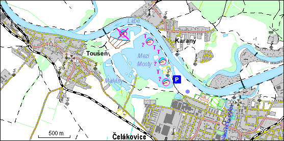
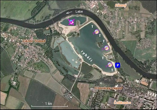
101. Celakovice
- Former sand quarry, 0.059 km²
- Celakovice 0.5 km
- long sand beach, shorter stony beach, some small beahces, CO, textiles significantly prevail
- Very clean water, but some waste in surroundings :(
- plan, aerial photo, maps
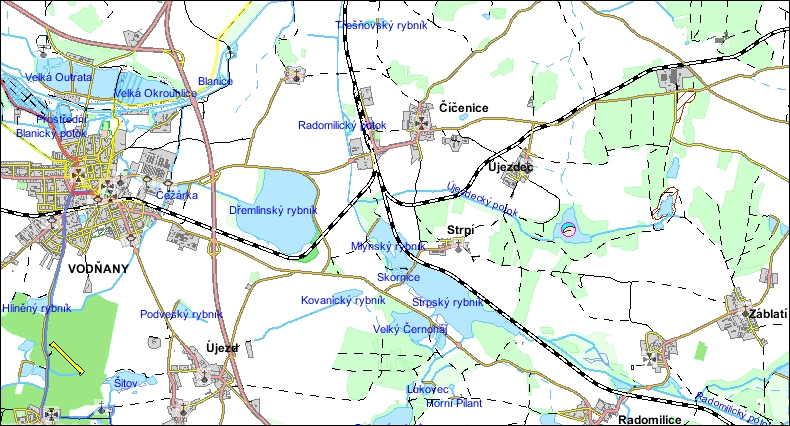
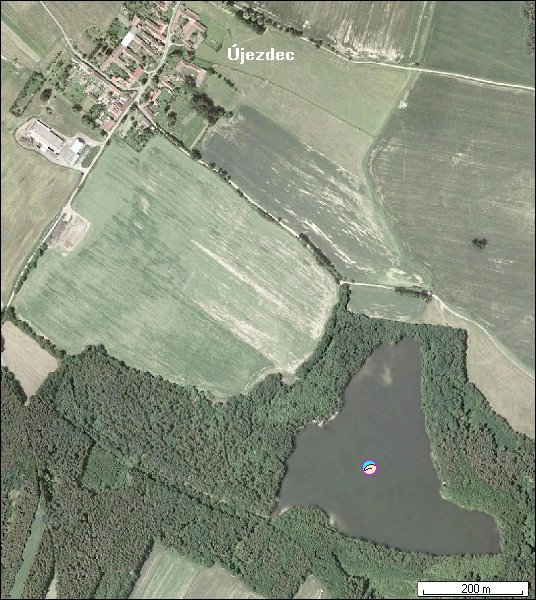
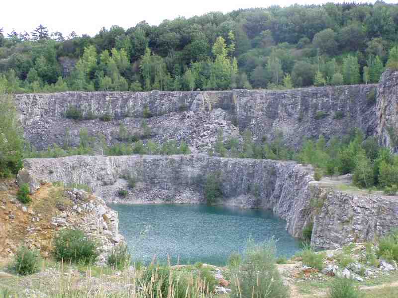
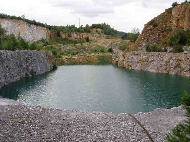
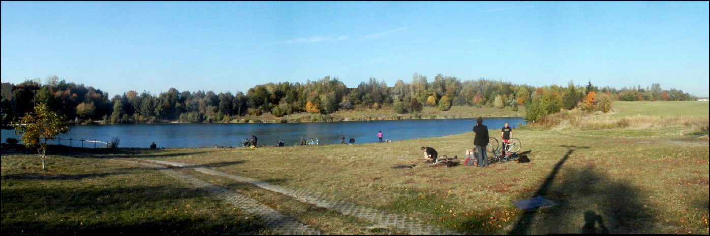
102. Ujezdec
- Former plumbago (graphite) quarry, 0,1 km²
- Vodnany 5 km, Cicenice 1.5 km, Ujezdec 500 m
- Nice clean water, in the middle of forests
- plan, aerial photo, maps
103. Homolak (+ Kosov) and Kosov Access prohibited by the owner
- limestone quarry lake, 0.01 km², unfortunately bit by bit decreased by a stone deposit
- Vinarice 1 km, Suchomasty 3 km, Menany 3 km, Koneprusy 4 km
- Nice clean water, very dangerous rocks both above and under water
- CO (T-majority), for Ns the western terrace is recommended
- views southwards, closer, northwards
- plan, aerial photo, satellite photo, maps
- Kosov: Near the village Jarov, 2 km southwest of Beroun; view, maps, aerial photo
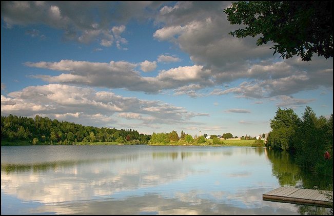
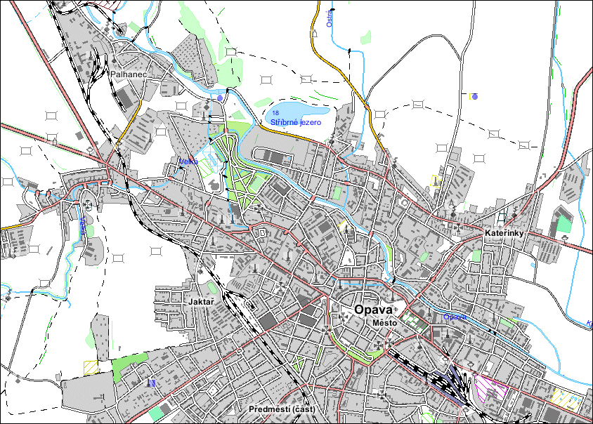
104. Opava - Sadrak (Stribrne jezero = Silver Lake)
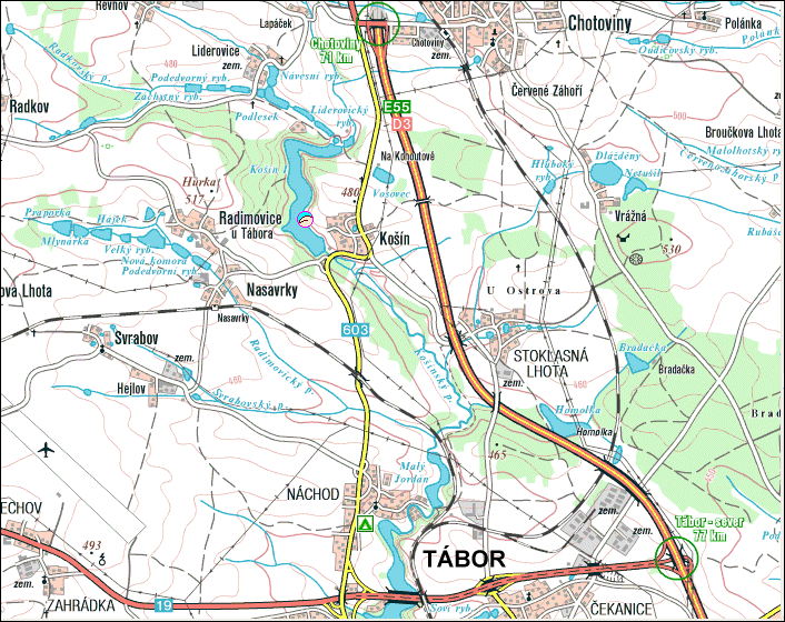
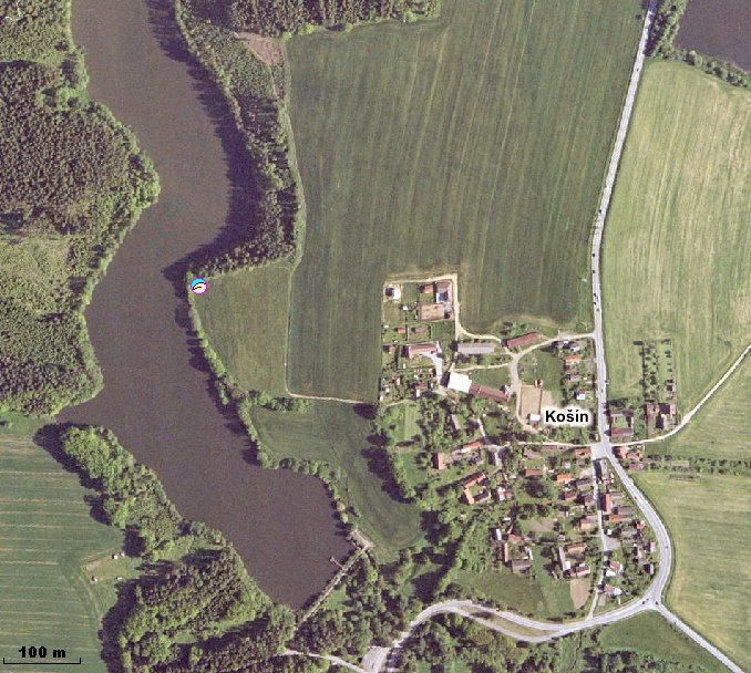
105. Kosin
